MAIN BESKID TRAIL – stage no. 7 Przełęcz Glinne – Markowe Szczawiny
[ENG]
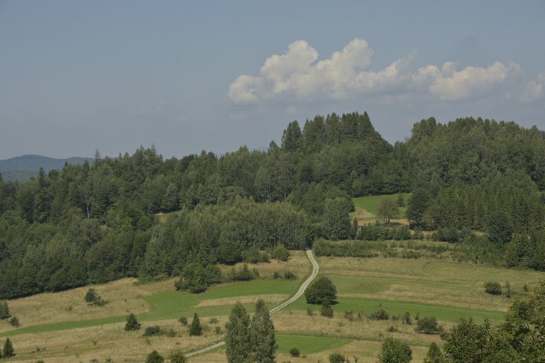
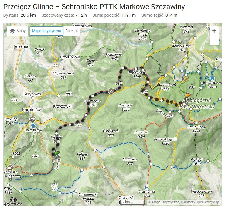
After a very long break in conquering the next stages of the Main Beskid Trail, there was finally an opportunity to face this longest trail in the Polish mountains again. We waited so long to set off on the next stages because starting from the place where we finished, i.e. at the Glinne Pass, to the next town, Jordanów, a 54-kilometer trek was to await us in the mountains. How to divide such a section so as not to waste too much time on leaving the trail and entering the trail. It was not an easy task, but I thought that if I tried to complete this section in 3 days in a row, staying overnight in the PTTK Markowe Szczawiny shelter along the way and then in the PTTK Na Hali Krupowej shelter. An ambitious plan, but it was only on the long August weekend that we managed to find three days off from work to devote them to such a long trek.
[PL]
Po bardzo długiej przerwie w zdobywaniu kolejnych etapów Głównego Szlaku Beskidzkiego wreszcie zdarzyła się okazja aby ponownie zmierzyć się z tym najdłuższym szlakiem polskich gór. Z ruszeniem na kolejne etapy czekaliśmy tak długo, ponieważ począwszy od miejsca w którym skończyliśmy czyli na Przełęczy Glinne, aż do kolejnego miasta czyli Jordanowa czekać na nas miała licząca 54 kilometry wędrówka po górach. Jak podzielić taki odcinek, aby nie tracić za dużo czasu na schodzenie ze szlaku i wchodzenie na szlak. To nie było łatwe zadanie, ale pomyślałem, że gdyby spróbować przejść ten odcinek w 3 dni z rzędu robiąc po drodze noclegi w schronisku PTTK Markowe Szczawiny i potem w schronisku PTTK Na Hali Krupowej. Plan ambitny, ale dopiero na długi weekend sierpniowy udało się wygospodarować trzy dni wolne od pracy aby poświęcić je na taki długi trekking.
[ENG]
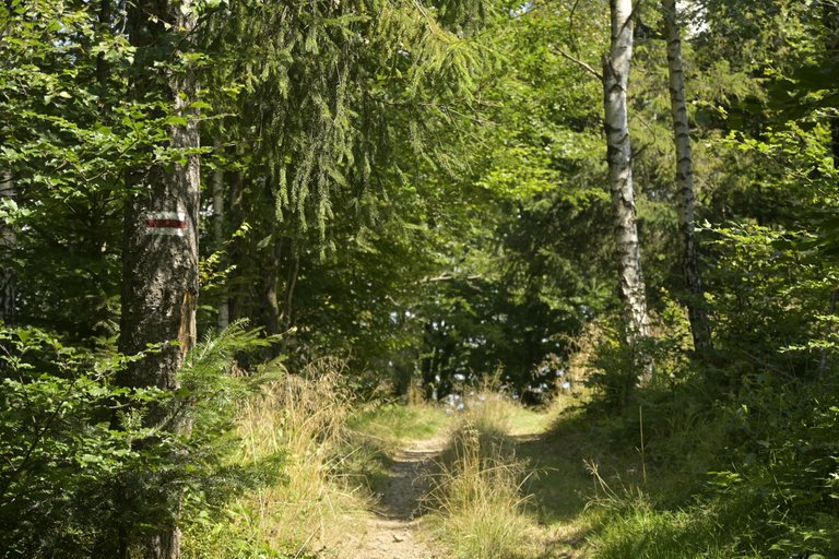
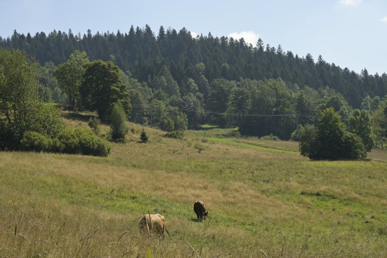
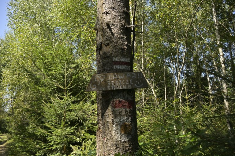
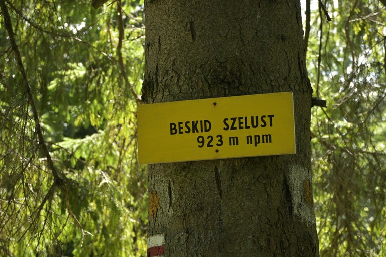
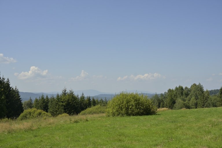
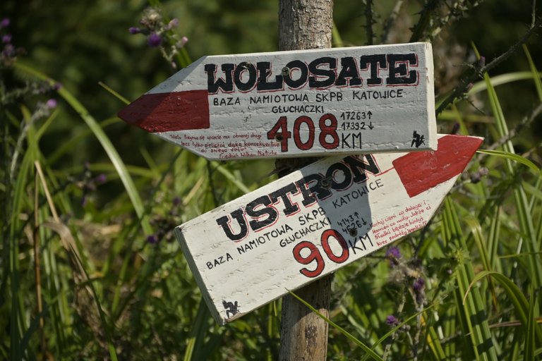
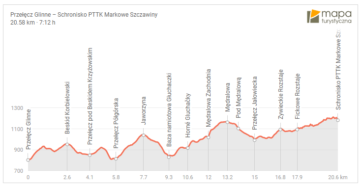
Getting to the Glinne Pass wasn't easy, because first we had to go from Krakow to Żywiec. It took us almost two hours, and only after reaching Żywiec did we have an additional 20 minutes of waiting for a change to Korbielów. The distance from Żywiec to Korbielów was already very short, but in total it turned out that even though we set off from Krakow at 8, we only entered the trail at 11:15. The day was very sunny, so whenever a section of the trail left the forest and entered the open space, it became so unbearably hot that after almost 5 minutes we had to take a break to drink water. Another problem I noticed was going to an altitude above 900 - 1000 meters above sea level. Then the mixed forest changed into a forest with a predominance of coniferous trees, and as a result, it let in much more sunlight and was also quite hot. The first peak on our way wasn't very big because Beskid Krzyzoiwski was 923 meters high, but the next mountain Jaworzyna with a height of 1045 meters above sea level gave us a real hard time. Fortunately, it was enough to descend from Jaworzyna and right at the pass we came across the Głuchaczki tent base. Here we took a half-hour break because we were only halfway to Markowe Szczawiny and we didn't have much strength left. I have no idea what happened next because it was a real fight for survival, but somehow with a huge effort we crawled to the shelter at 7 pm.
[PL]
Dojazd na Przełęcz Glinne nie był łatwy, bo najpierw musieliśmy z Krakowa pojechać do Żywca. Trwało to nam prawie dwie godziny i dopiero po dojechaniu do Żywca mieliśmy dodatkowo 20 minut czkania na przesiadkę do Korbielowa. Z Żywca do Korbielowa droga była już bardzo niedługa, ale sumarycznie wyszło, że mimo iż z Krakowa ruszyliśmy o godzinie 8 to na szlak weszliśmy dopiero o 11:15. Dzień był bardzo słoneczny dlatego gdy tylko jakiś odcinek szlaku wychodził z lasu na otwartą przestrzeń robiło nam się tak bardzo nieznośnie gorąco, że niemal po 5 minutach musieliśmy robić przerwę na picie wody. Kolejny problem jaki dostrzegłem, to wychodzenie na wysokość powyżej 900 - 1000 metrów nad poziomem morza. Wówczas las mieszany zmieniał się w las o przewadze drzew iglastych, a co za tym idzie przepuszczał dużo więcej promieni słonecznych i też był dość mocno nagrzany. Pierwszy szczyt na naszej drodze nie był zbyt wielki bo Beskid Krzyzoiwski liczył 923 metrów wysokości, ale kolejna góra Jaworzyna o wysokości 1045 metrów nad poziomem morza dała nam już bardzo mocno w kość. Na szczęście wystarczyło zejść z tej Jaworzyny i zaraz na przełęczy trafialiśmy na bazę namiotową Głuchaczki. Tutaj zrobiliśmy sobie półgodzinną przerwę, bo byliśmy dopiero w połowie drogi do Markowych Szczawin, a sił nie mieliśmy już za wiele. To co działo się później nie mam pojęcia, bo to była istna walka o przetrwanie, ale jakimś cudem z ogromnym wysiłkiem na godzinne 19 doczłapaliśmy się do schroniska.
[ENG]
In the shelter, after a quick check-in and taking our beds, we went to the restaurant and ordered something to eat, because we were already very hungry. Unfortunately, the quality of the dishes served was really very low. The sour rye soup was nothing special, but it was edible, but the potato pancakes were a nightmare. Hard, rubbery and greasy, just a nightmare, if it weren't for the fact that I don't like throwing away food, I simply wouldn't eat them. I put a big red exclamation mark next to Markowe Szczawiny in my private ranking of mountain shelters.
On the second day, something very bad happened, which completely ruined our plans for the next hike. We got up at 6:30 because the route that day was long and we wanted to cover as much of it as possible before the hot afternoon, but as soon as we finished eating breakfast at around 7:00 a.m. a heavy storm suddenly broke out. The worst peak in the entire Polish Beskids where you can spend a storm is Babia Góra, which we were supposed to climb in an hour. We waited in the shelter until 10 a.m. and since the weather forecast was not optimistic, we decided to give up and instead of going up we went down the green trail to the parking lot in Zawoja. This is how our unsuccessful attempt to go through 10% of the Main Beskid Trail in one go ended.
[PL]
W schronisku po szybkim zameldowaniu i zajęciu swoich łóżek poszliśmy do restauracji i zamówiliśmy coś do jedzenia, bo byliśmy już bardzo głodni. Niestety jakość zaserwowanych dań była naprawdę bardzo niska. Żur jak żur szału nie było, ale dało się zjeść, natomiast placki ziemniaczane, to był koszmar. Twarde, gumiaste i tłuste no po prostu koszmar, gdyby nie to, że nie lubię wyrzucać jedzenie to po prostu nie zjadłbym ich. Duży czerwony wykrzyknik postawiłem przy Markowych Szczawinach w moim prywatnym rankingu schronisk górskich.
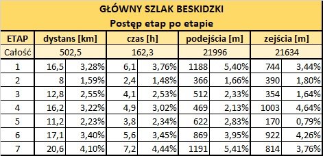
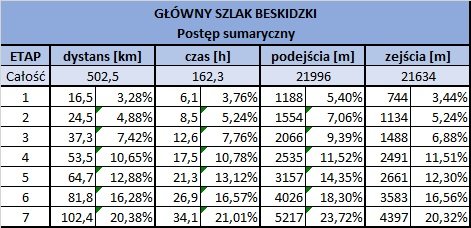
Drugiego dnia wydarzyło się coś bardzo złego, co kompletnie pokrzyżowało nam plany na dalsza wędrówkę. Wstalismy o 6:30 bo trasa tego dnia była długa i chcieliśmy jak największą jej część przejść przed upalnym południem, ale gdy tylko kończyliśmy jeść śniadanie około godziny 7:00 nagle rozpętała się mocna burza. Najgorszy szczy w całych Polskich Beskidach na jakim można spędzić burzę to właśnie Babia Góra , na którą mieliśmy za godzinę wchodzić. Przeczekaliśmy w schronisku do godziny 10 a że prognozy pogody nie były optymistyczne, zdecydowaliśmy się poddać i zamiast iść w górę zeszliśmy po zielonym szlaku na parking w Zawoi. Tak właśnie zakończyła się nasza nieudana próba przejścia za jednym zamachem 10% Głównego Szlaku Beskidzkiego.
Congratulations, your post has been added to the TravelFeed Map! 🎉🥳🌴
Did you know you have your own profile map?
And every post has their own map too!
Want to have your post on the map too?
- Go to TravelFeed Map
- Click the create pin button
- Drag the marker to where your post should be. Zoom in if needed or use the search bar (top right).
- Copy and paste the generated code in your post (any Hive frontend)
- Or login with Hive Keychain or Hivesigner and click "create post" to post to Hive directly from TravelFeed
- Congrats, your post is now on the map!
PS: You can import your previous Pinmapple posts to the TravelFeed map.Opt Out
Congratulations, your post has been added to WorldMapPin! 🎉
Did you know you have your own profile map?
And every post has their own map too!
Want to have your post on the map too?
Congratulations @olusiu! You received the biggest smile and some love from TravelFeed! Keep up the amazing blog. 😍 Your post was also chosen as top pick of the day and is now featured on the TravelFeed front page.
Thanks for using TravelFeed!
@for91days (TravelFeed team)
PS: You can now read your favourite travel blogs on your phone. Plus, blogging on-the-go just got easier! Download our app on the Apple App Store or get it on Google Play.
Hiya, @ybanezkim26 here, just swinging by to let you know that this post made it into our Honorable Mentions in Travel Digest #2294.
Your post has been manually curated by the @worldmappin team. If you like what we're doing, please drop by to check out all the rest of today's great posts and consider supporting other authors like yourself and us so we can keep the project going!
Become part of our travel community:
@tipu curate 8
Upvoted 👌 (Mana: 0/75) Liquid rewards.
What very beautiful view and the place looks so cool
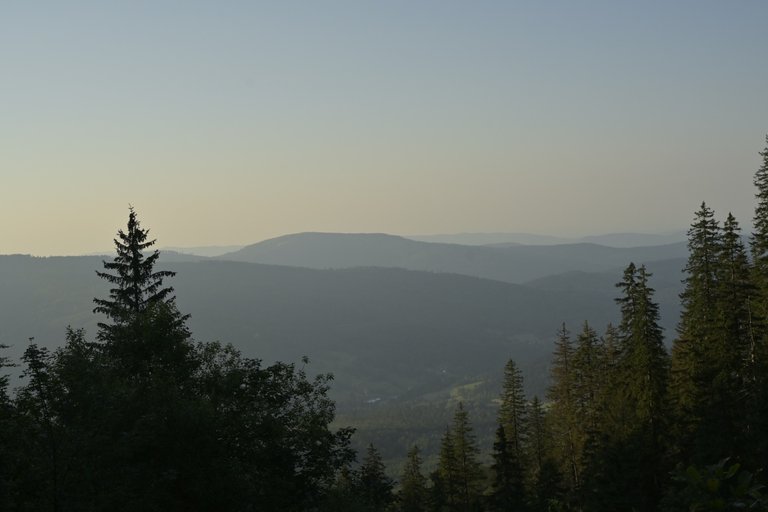
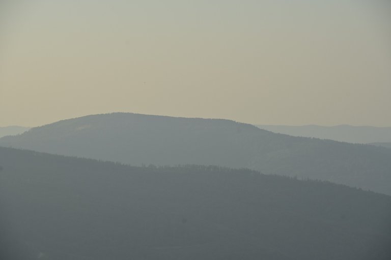
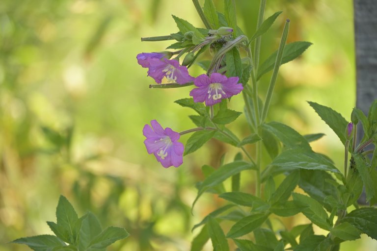
wow it's a really amazing travel with photography the flower is very nice. Thank you very much for sharing that wonderful view of the hill town covered in fog. Also it is a real pleasure to see these amazing mountains from a distance and take a trip after the overlook at various times. Thank you so much for sharing such joy.
witam z powrotem na GSB! Szkoda, że nie udało się przejść fragmentu z Babią Górą. Kiedy wracacie na szlak?
PS. Jest w tekście literówka - Beskid Krzyzoiwski => Krzyżowski
Dzięki za korektę! Na GSB wrócimy pewnie dopiero w drugiej połowie września.
to jeżeli Babia Góra wypadnie w weekend to chętnie dotrzymam wam towarzystwa. Na razie mam plany do 14.09 włącznie, potem weekendy do zagospodarowania
Hello olusiu!
It's nice to let you know that your article won 🥈 place.
Your post is among the best articles voted 7 days ago by the @hive-lu | King Lucoin Curator by sarmaticus
You and your curator receive 0.0237 Lu (Lucoin) investment token and a 8.56% share of the reward from Daily Report 398. Additionally, you can also receive a unique LUSILVER token for taking 2nd place. All you need to do is reblog this report of the day with your winnings.
Buy Lu on the Hive-Engine exchange | World of Lu created by @szejq
STOPor to resume write a wordSTART