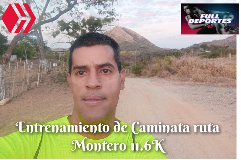
Entrenamiento de Caminata ruta Montero 11.6K
Greetings friends of Hive and @fulldeportes, today I am going to share with you this mountain walking training that I did on the Montero route, in the community of Villa de Cura, Zamora municipality, Aragua state.
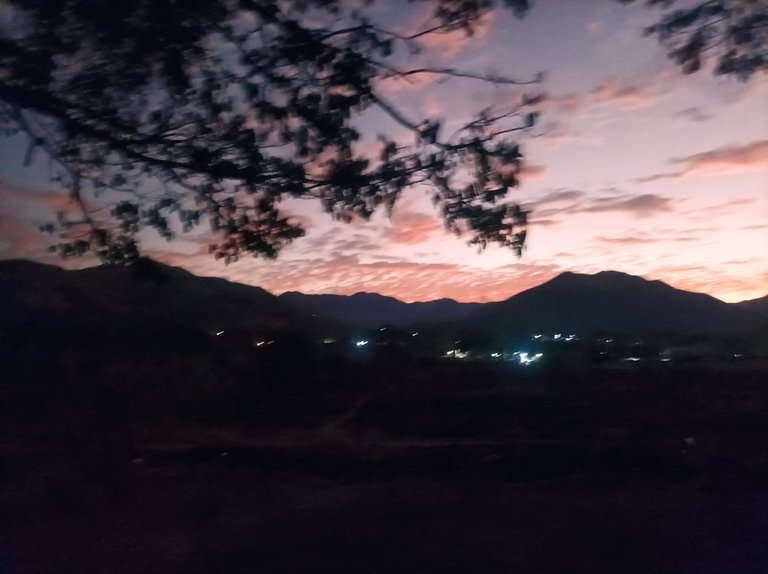
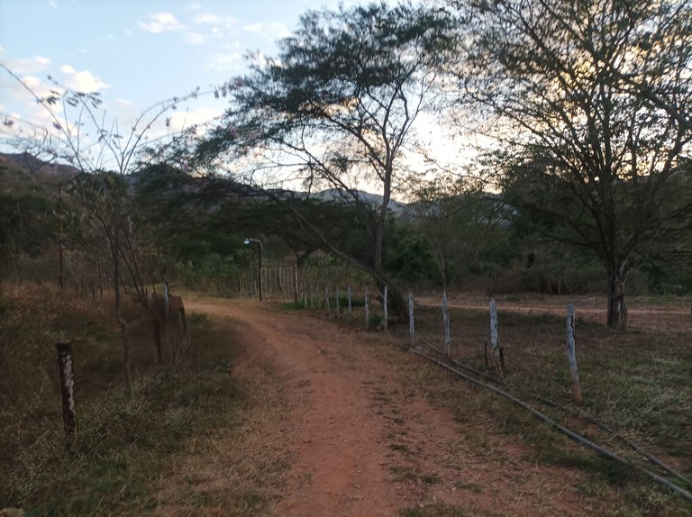
Cabe destacar que este entrenamiento lo tenía planificado para el asentamiento campesino de Montero, me levanté bien temprano a la 5:40 am ya estaba haciendo mis ejercicios de calentamiento, esperando que mi amigo llegará para arrancar, lo espere hasta la 5:55, pero no llegó , por lo cual decidí salir desde la avenida Lisandro Hernández, activando la aplicación Strava para registrar esta ruta, todavía estaba un poco oscuro, con algo de frío, al pasar por frente al monumento Ezequiel Zamora, llevaba un tiempo de 20 minutos con 36 segundos.
It should be noted that I had planned this training for the peasant settlement of Montero, I got up very early at 5:40 am, I was already doing my warm-up exercises, waiting for my friend to arrive to start, I waited for him until 5:55, but he did not arrive, so I decided to leave from Lisandro Hernández Avenue, activating the Strava application to record this route, it was still a little dark, a little cold, when passing in front of the Ezequiel Zamora monument, I had a time of 20 minutes and 36 seconds.
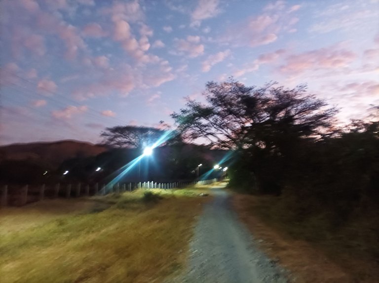
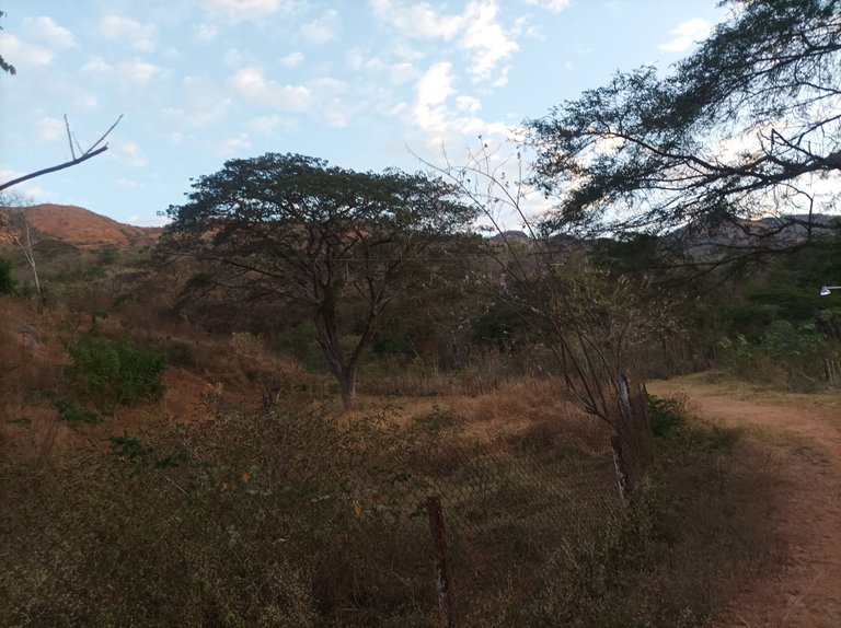
En este entrenamiento, no accedí por la primera entrada del asentamiento campesino, sino que seguí por toda la carretera nacional, después de pasar el monumento, continúe avanzando, en ese momento me pasaron varios amigos corredores, luego llegué a la segunda entrada que está cerca del Samán, con un tiempo de 26 minutos con 40 segundos y luego complete los 3K con un tiempo de 29 minutos con 30 segundos, a penas estaba aclarando.
In this training, I did not enter through the first entrance of the peasant settlement, but rather I continued along the entire national highway, after passing the monument, I continued moving forward, at that moment several runner friends passed me, then I arrived at the second entrance that is near Samán, with a time of 26 minutes and 40 seconds and then I completed the 3K with a time of 29 minutes and 30 seconds, it was barely clear.
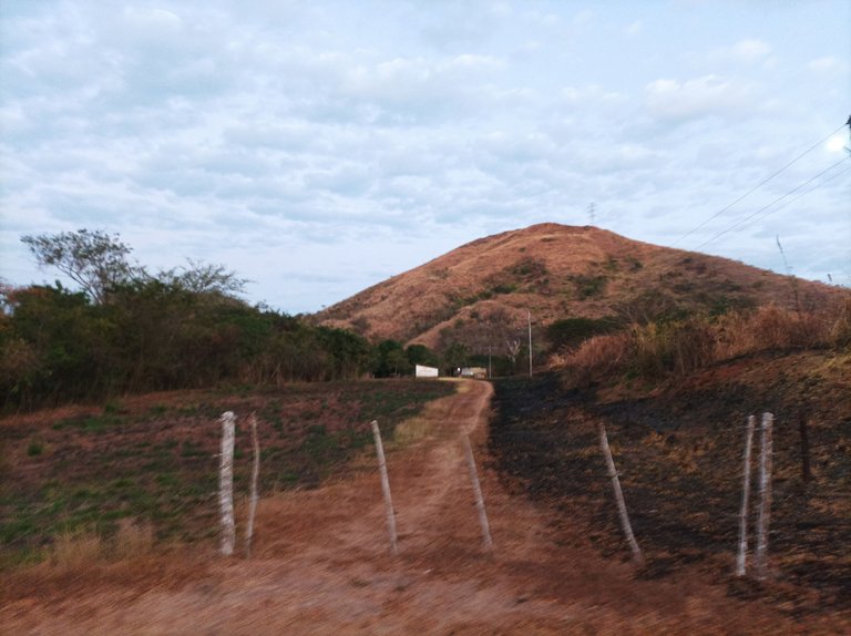
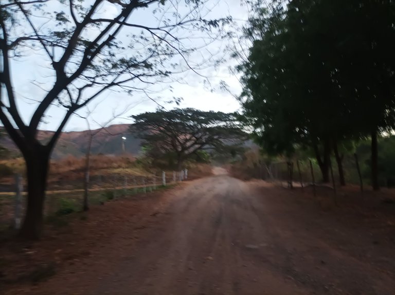
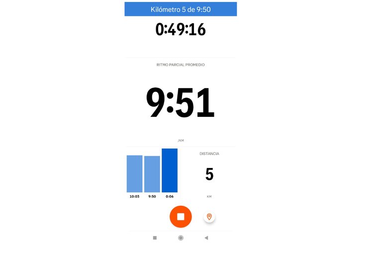
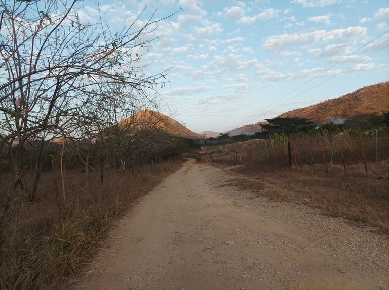
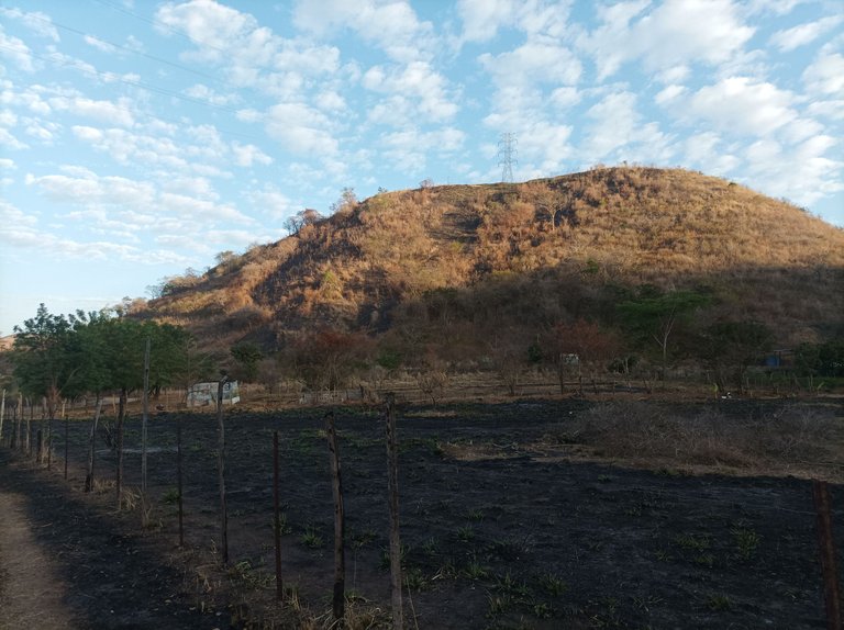
Después pasé el puente del rio Las Mercedes, este recorrido a partir de acá es una superficie de tierra, totalmente plano, seguí al mismo paso promedio de 10 minutos por Kilometros, al llegar hasta la vaquera ya había recorrido los 5K en un tiempo de 49 minutos con 16 segundos, faltando poco para llegar a la parte final para después regresarme. Los zapatos ya estaba llenos de mucho polvo por la carretera y también por la sequía.
Afterwards I passed the Las Mercedes River bridge, this route from here on is a dirt surface, completely flat, I continued at the same average pace of 10 minutes per kilometer, when I reached the cowgirl I had already covered the 5K in a time of 49 minutes and 16 seconds, with little left to reach the final part and then return. The shoes were already full of dust from the road and also from the drought.
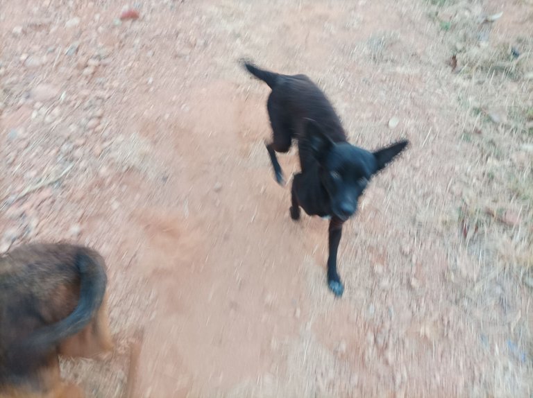
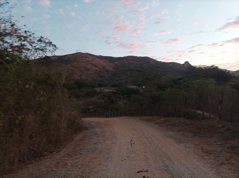
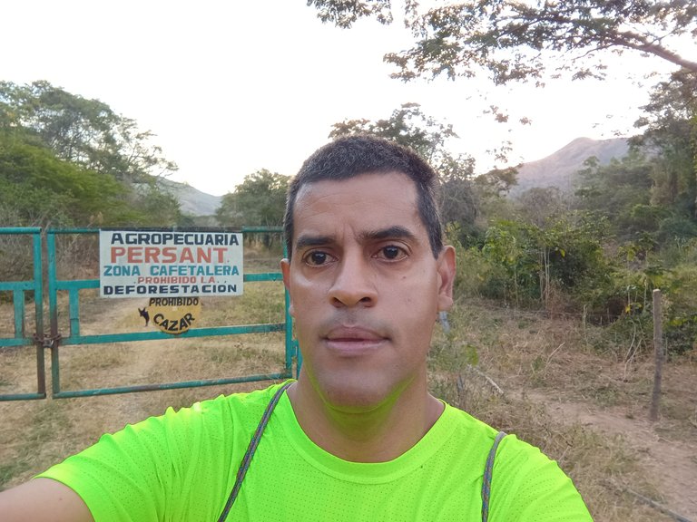
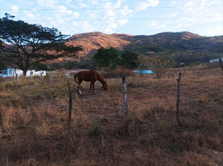
Casi llegando al final de este asentamiento me tope con un perrito que me acompañó, al llegar a la hacienda Persant llevaba una distancia de 6.34K, me hidrate un poco y luego retorne, pero no me vine nuevamente por la misma via que hacía la carretera nacional, sino que mantuve la ruta por todo el asentamiento campesino de Montero, y después salí por la primera entrada hacia la avenida Lisandro Hernández muy cerca de la escuela Teresa Carreño.
Almost reaching the end of this settlement, I ran into a little dog that accompanied me. When I arrived at the Persant ranch, I had a distance of 6.34K. I hydrated myself a little and then returned, but I did not come back along the same route that the national highway took, but rather I kept the route through the entire peasant settlement of Montero, and then I left through the first entrance towards Lisandro Hernández Avenue, very close to the Teresa Carreño school.
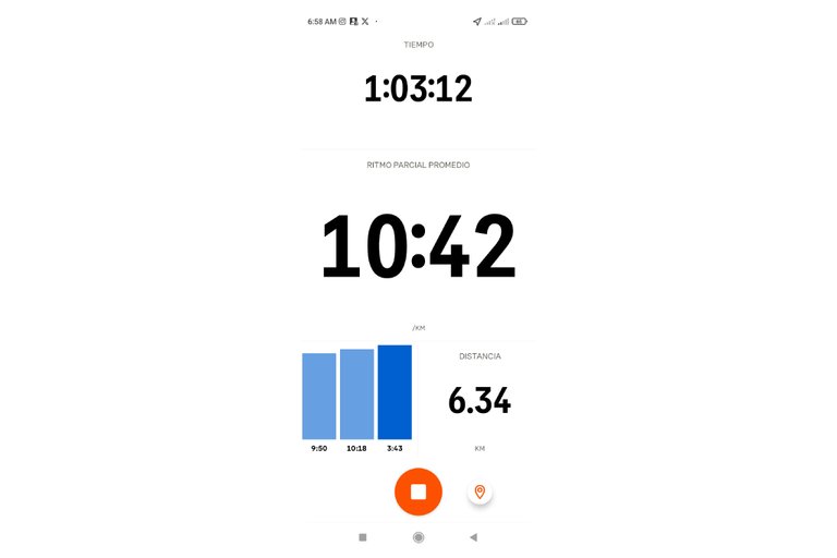
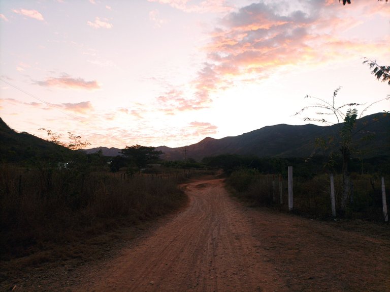
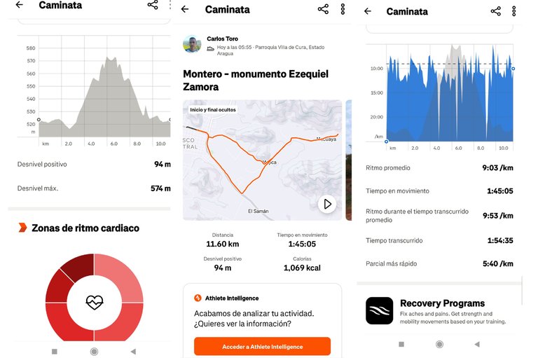
Finalmente llegué al mismo punto de salida en esta con un tiempo de 1 hora 54 minutos, con una distancia de 11.60K, un desnivel positivo 94 m de y un desnivel máximo de 574 m, registrado en la aplicación Strava.
I finally reached the same starting point in this one with a time of 1 hour 54 minutes, with a distance of 11.60K, a positive gradient of 94 m and a maximum gradient of 574 m, recorded in the Strava application.
Echa un vistazo a mi caminata en Strava: https://strava.app.link/uymumZhU2Qb
Check out my walk on Strava: https://strava.app.link/uymumZhU2Qb
Espero que les haya gustado, nos vemos en una próxima publicación.
I hope you liked it, see you in a next post.
Fotografías: Teléfono Redmi Note 10
Portada realizada en APP GridArt
Logos utilizados de Hive y de @fulldeportes
Traductor utilizado: Traductor de Google
Photos: Redmi Note 10 Phone
Cover made in The APP GridArte
Used logos of Hive and @fulldeportes
Translator used: Translator used: Google Translate

Vote la-colmena for witness By @ylich

Ver como el sol va abrazando la montana es una imagen extasiante...pararse los domingos muy temprana para entrenar y adentrarse en la naturaleza es un privilegio que pocos aprovechan, te felicito por la voluntad y disciplina @cetb2008...saludos
Hola, muchas gracias, abrazos