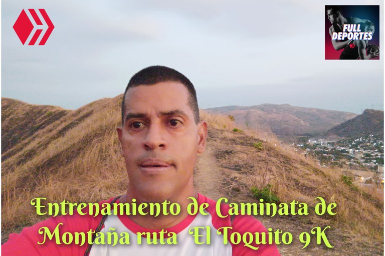
Entrenamiento de Caminata de Montaña ruta El Toquito 9K
Greetings friends of Hive and @fulldeportes, today I am going to share with you my mountain walking training on Cerro El Toquito, in the community of Villa de Cura, Zamora municipality, Aragua state.
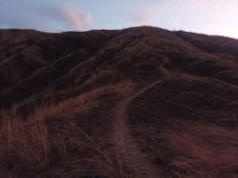
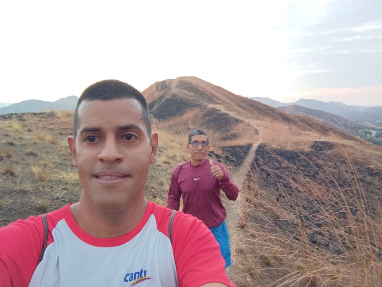
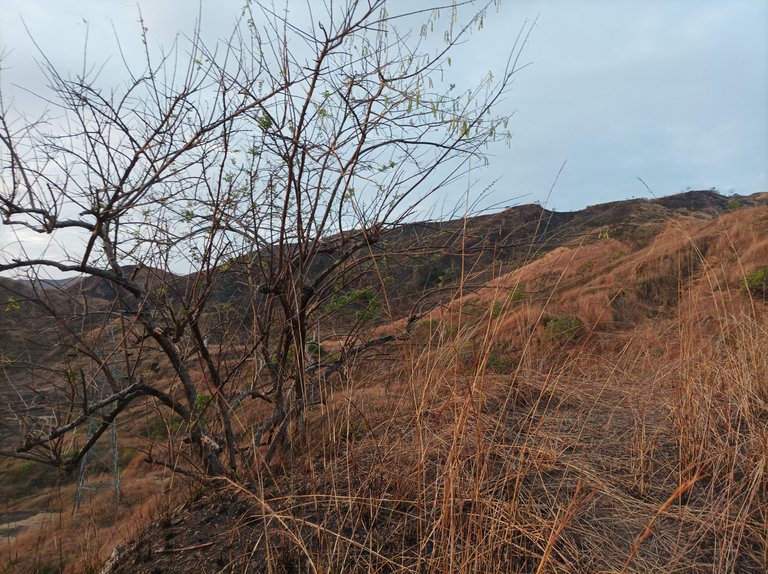
Cabe destacar que en este entrenamiento me había puesto de acuerdo para entrenar con un amigo, me levanté bien temprano y al salir comencé a realizar los ejercicios de calentamiento, iniciamos el recorrido a las 5:38 am, activando la aplicación Strava para registrar esta ruta. Subimos por toda la calle doctor Morales y después cruzamos para pasar por la avenida Urdaneta, con un clima fresco y estaban un poco oscuro.
It should be noted that in this training I had agreed to train with a friend, I got up very early and when I left I began to do the warm-up exercises, we started the route at 5:38 am, activating the Strava application to record this route. We went up Doctor Morales Street and then crossed to go through Urdaneta Avenue, with cool weather and it was a little dark.
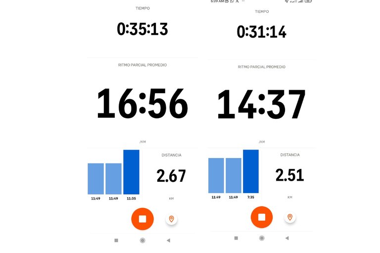
Después de pasar por el centro de la comunidad de Villa de Cura, comenzamos a subir por el sector del Toquito, frente a los edificios, y complete la distancia de 2K con un tiempo de 23 minutos con 47 segundos, luego llegamos al frente de la montaña, para iniciar el ascenso, tuve que prender la linterna de mi teléfono móvil porque apenas estaba aclarando, esta ruta tiene tres pendientes que están seguidas , pude completar las dos primeras y llegar a la cima con un tiempo de 31 minutos con 14 segundos.
After passing through the center of the Villa de Cura community, we began to climb through the Toquito sector, in front of the buildings, and completed the distance of 2K with a time of 23 minutes and 47 seconds, then we reached the front of the mountain, to start the ascent, I had to turn on the flashlight of my mobile phone because it was just getting clear, this route has three slopes that are in a row, I was able to complete the first two and reach the top with a time of 31 minutes and 14 seconds.
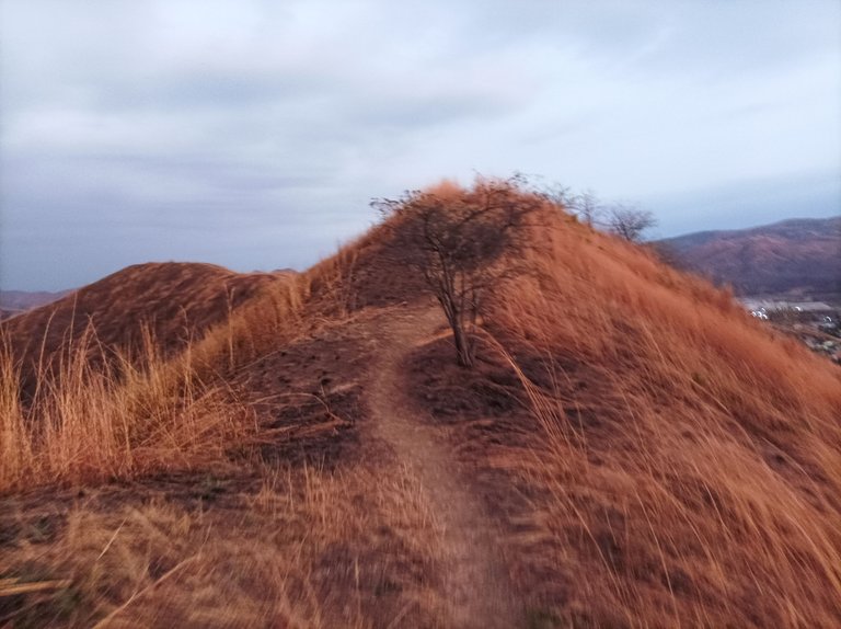

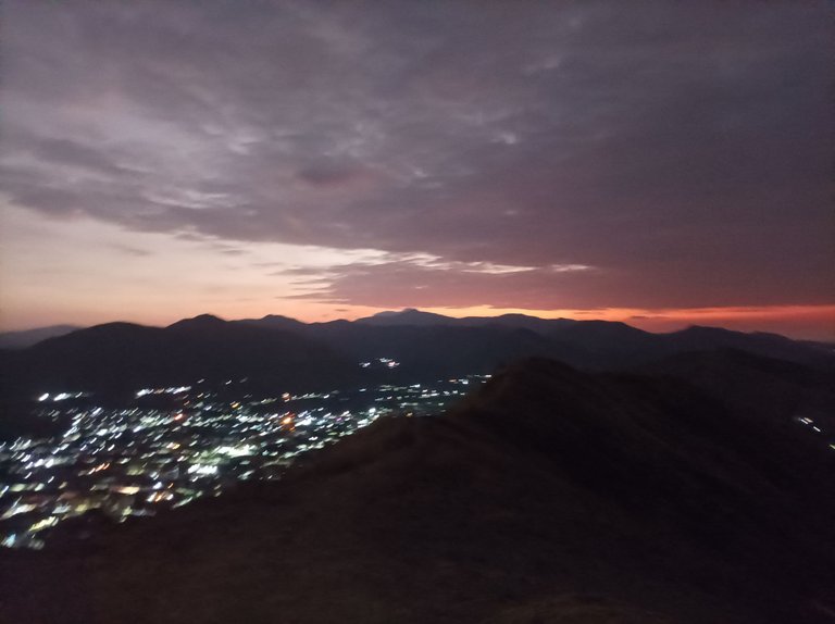
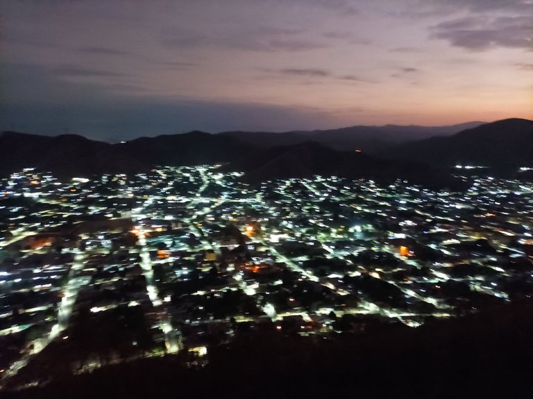
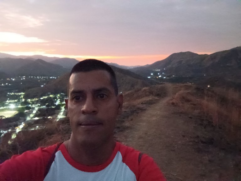
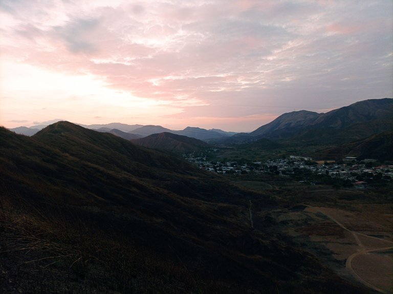
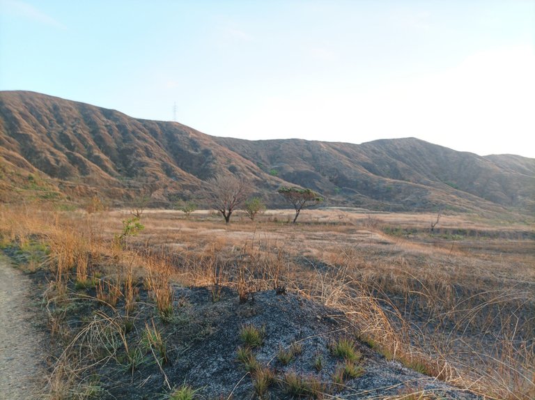
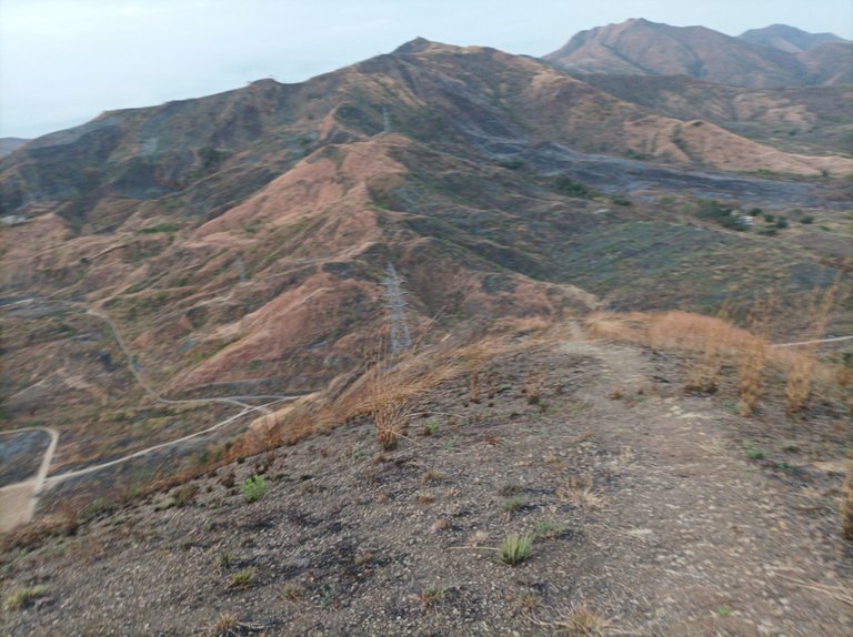
Luego continúe avanzando, para llegar a la cima de la tercera y última subida con un tiempo de 35 minutos con 13 segundos, desde la parte alta se podía apreciar la salida del sol en la montaña, y toda la comunidad de Villa de Cura y el sector del Toquito. Después me desplace a la derecha de esta montaña para llegar a la punta, y bajar como 400 metros , en esta parte me hidrate y me regresé por el mismo sitio, encontrando con varios subidas al retornar.
Then continue moving forward, to reach the top of the third and final climb with a time of 35 minutes and 13 seconds. From the top you could see the sunrise on the mountain, and the entire community of Villa de Cura and the Toquito sector. Afterwards I moved to the right of this mountain to reach the tip, and descend about 400 meters, in this part I hydrated and returned to the same place, encountering several climbs on the way back.
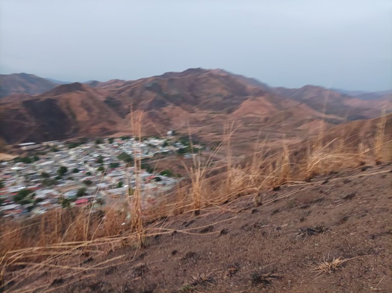
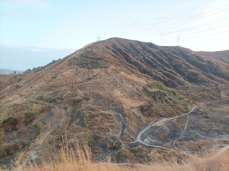
Asimismo mi amigo se había quedado rezagado porque sentía una molestia en la pierna, lo alcance y caminamos a la derecha de la montaña, para comenzar el descenso y bajar por detrás de la pista de atletismo, registrando una distancia de 5K en un tiempo de 1 hora 11 minutos,. Mi amigo se quedó esperándome en la pista y yo continúe subiendo la montaña que está frente a la pista para dar una vuelta y nuevamente llegar a la pista.
Likewise, my friend had been left behind because he felt discomfort in his leg, so I caught up with him and we walked to the right of the mountain, to begin the descent and go down behind the athletics track, recording a distance of 5K in a time of 1 hour 11 minutes. My friend stayed waiting for me on the track and I continued climbing the mountain in front of the track to take a turn and reach the track again.
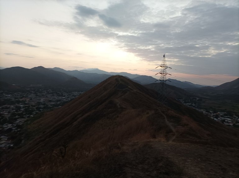
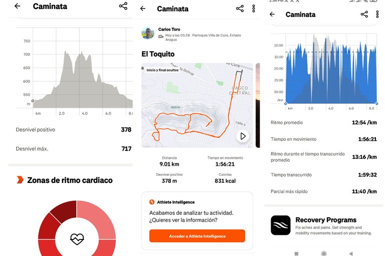
Una vez que llegue a la pista, continuamos nuestro recorrido para pasar por la comunidad del Toquito y bajar un poco.y llegar al centro de la comunidad de Villa de Cura al mismo punto de partida con un tiempo final de 1 hora 59 minutos, con una distancia de 9K, con un desnivel positivo de 368m y un desnivel negativo de 717m, registrado en la aplicación Strava.
Once we reach the track, we continue our tour to pass through the community of Toquito and go down a little and reach the center of the community of Villa de Cura at the same starting point with a final time of 1 hour 59 minutes, with a distance of 9K, with a positive gradient of 368m and a negative gradient of 717m, recorded in the Strava application.
Espero que les haya gustado, nos vemos en una próxima publicación.
I hope you liked it, see you in a next post.
Fotografías: Teléfono Redmi Note 10
Portada realizada en APP GridArt
Logos utilizados de Hive y de @fulldeportes
Traductor utilizado: Traductor de Google
Photos: Redmi Note 10 Phone
Cover made in The APP GridArte
Used logos of Hive and @fulldeportes
Translator used: Translator used: Google Translate

Vote la-colmena for witness By @ylich

¡Tremenda caminata, hermano! Subiste más que mi motivación los lunes. 😂 Espero que tu amigo haya sobrevivido a la travesía y que Strava no haya colapsado con tanto registro. ¡Saludos y a seguir dándole! 💪😆
Saludos amigo, gracias por pasar y comentar.
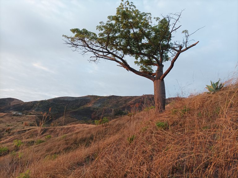
Hola profe, interesantes fotos que muestran la ciudad al amanecer luego de la madrugada y me llamó la atención ese ejemplar de Ceiba, ese gran árbol que parece estuviera "embarazado" je je, saludos cordiales.
Hola si, no sabía que se llamaba así, gracias por tu comentario.
Saludos amigo @cetb2008, siempre veo que sobre la misma rutas nos muestras imágenes diferentes del mismo paisaje, día, noche , madrugada al igual que la vegetación, agradezco este registro al detalle de estos paisajes locales que gracias a Ud. se pueden dar a conocer a través de esta gran comunidad. Éxitos profe.
Saludos amigo, si ese es amaneciendo, gracias a ti por tu comentario amigo.